
Washington’s Mount Rainier has entered an unusual 72‑hour tremor phase, prompting global headlines about “America’s deadliest volcano.” Here’s what is actually happening, what scientists are saying, and what it means for people in the Seattle–Tacoma region.
What Just Happened at Mount Rainier?
For three straight days, Washington’s Mount Rainier has been shaking with a continuous, high‑energy seismic “hum” that volcanologists describe as a 72‑hour volcanic tremor phase rather than a typical earthquake swarm. The News International+2freerepublic.com+2
According to reports drawing on data from the Pacific Northwest Seismic Network (PNSN), seismometers on Rainier’s west flank have logged nearly nonstop signals since Saturday, November 15, with thousands of tiny vibrations blending into a single fuzzy band on seismograms — a classic signature of volcanic tremor. The News International+2freerepublic.com+2
International coverage from outlets such as The News International and republished Daily Mail content describes this as one of the longest and most intense tremor episodes recorded at Mount Rainier in recent years, warning that it has effectively “raised the eruption warning” for one of America’s most dangerous volcanoes and placed millions of people in nearby cities on alert. The News International+2freerepublic.com+2
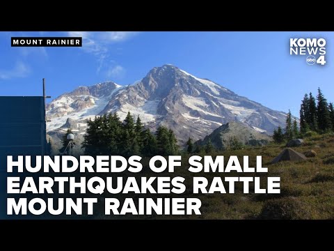
The volcano towers over the Seattle–Tacoma metropolitan area and its wider drainage basin, home to more than 3.3 million people, plus hundreds of thousands more downstream in southwest Washington and northwest Oregon. National Park Service+1
So is this the start of a major eruption — or a dramatic but ultimately benign episode?
Is an Eruption Imminent?
Despite the intense tremor and sensational headlines, official U.S. monitoring agencies have not raised Mount Rainier’s alert level as of this morning.
The U.S. Geological Survey’s Cascades Volcano Observatory (USGS CVO) weekly update from November 14, 2025 still lists all Cascade volcanoes — including Mount Rainier — at Alert Level: NORMAL and Aviation Color Code: GREEN, noting only small, background earthquakes at Rainier and its neighbors. volcanoes.usgs.gov+1
No public Volcano Notification (VONA) or special status change for Rainier has been issued since that bulletin, and USGS continues to describe current Cascades activity as consistent with background levels. volcanoes.usgs.gov+1
In other words:
- Media warning language ≠ official eruption alert. International outlets are using phrases like “eruption warning raised” to communicate elevated concern, but the formal U.S. alert scale has not changed. The News International+2The News International+2
- Scientists are watchful, not panicked. Volcanologists are treating this as a serious signal that merits close monitoring, especially if tremor strength increases, new earthquakes appear, or the ground begins to swell. lechaudrondevulcain.com+2freerepublic.com+2
This tension between dramatic seismic data and a still‑green alert level is part of what makes today’s situation at Rainier so unnerving — and so easy to misunderstand.
What Is Volcanic Tremor, and Why Does 72 Hours Matter?
To non‑experts, an “earthquake swarm” and a “tremor phase” may sound like the same thing. In volcano monitoring, they’re very different beasts.
- Earthquake swarm: Many discrete quakes, each with a clear start and end.
- Volcanic tremor: A continuous vibration — a long, unbroken rumble that can last minutes, hours, or even days, usually linked to the movement of magma, hot water, or gas within a volcano. pubs.usgs.gov+1
In this case, seismologists report that Rainier’s instruments show:
- A sharp spike in energy early on November 15
- Followed by three days of nearly constant, high‑energy tremor across its west flank
- A seismogram that transitions from distinct blips (earthquakes) into a fuzzy band of noise — the hallmark of tremor rather than regular quakes freerepublic.com+1
Volcanic tremor is not automatically a sign of imminent eruption. It often reflects pressurized fluids — super‑heated water, steam, or small amounts of magma — circulating through cracks and conduits, which is why USGS educational materials emphasize that tremor must be interpreted along with ground deformation, gas output, and other indicators. pubs.usgs.gov+1
However, the unusual duration and intensity of this 72‑hour episode at Mount Rainier is what has caught experts’ attention. It’s rare to see such sustained tremor at a volcano that has been quiet for centuries but is known to be capable of catastrophic mudflows.
Why Mount Rainier Is Called “America’s Most Dangerous Volcano”
Strictly speaking, the deadliest eruption on U.S. soil in recorded history belongs to Kīlauea’s 1790 Keanakakoʻi eruption in Hawaii. Wikipedia
But when scientists, planners, and journalists call Mount Rainier “America’s most dangerous volcano,” they’re talking about future risk, not past body counts.
According to the USGS and the National Park Service, Rainier is considered the most hazardous volcano in the Cascade Range — and potentially the most dangerous in the continental United States — for several reasons: USGS+2USGS+2
- Huge ice load: Rainier carries more snow and glacier ice than all other Cascade volcanoes combined. USGS+1
- Steep, unstable slopes: Parts of its upper flanks are composed of weakened, hydrothermally altered rock, prone to landslides. USGS+1
- Lahar machine: When rock collapses or magma rapidly melts ice, water mixes with ash and debris to form lahars — volcanic mudflows that can race down valleys at highway speeds. USGS+2USGS+2
- Dense populations downstream: Lahar paths lead directly through towns like Orting, Puyallup, Sumner, and Auburn, and onward into the broader Seattle–Tacoma region and the Puget Sound lowlands. pubs.usgs.gov+1
USGS hazard assessments note that large historic lahars from Rainier have:
- Traveled tens of miles from the volcano
- Reached depths of up to 150 meters (490 feet) in narrow valleys
- Extended all the way to the shores and even the floor of Puget Sound in past “Osceola‑style” events USGS+2pubs.usgs.gov+2
The key point: For Rainier, the main killer is not lava — it’s mud. Lahars can destroy bridges, bury highways, and engulf entire neighborhoods in a matter of minutes.
From Summer Swarms to Autumn Tremor: A Restless Year on the Mountain
This 72‑hour tremor comes on the heels of an already active year beneath Mount Rainier.
July 2025: Record Earthquake Swarm
- On July 8, 2025, USGS and PNSN reported an earthquake swarm beneath the summit, with more than 1,200 tiny quakes recorded over several weeks — the largest swarm ever documented at Rainier. USGS+2Axios+2
- Most quakes were between 1.2 and 3.7 miles deep and too small to be felt at the surface. AP News+1
- Scientists attributed the swarm to natural fluid movement in the volcano’s hydrothermal system and stressed that there were no signs of magma rising, no unusual ground deformation, and no reason to change the volcano’s alert status. USGS+2AP News+2
November 2025: Tremor Takes Over
The current episode is different:
- Instead of hundreds of discrete quakes, seismometers are now picking up one continuous, long‑duration tremor across Rainier’s west flank. The News International+2freerepublic.com+2
- International media are describing it as a “72‑hour long and extreme tremor phase”, unusual even by Rainier’s restless standards. The News International+2ABDPost.com Amerika’dan Haberler+2
Taken together, July’s record swarm and November’s prolonged tremor paint a picture of a volcano whose deep plumbing system is active — but not necessarily on the brink of eruption. USGS fact sheets explicitly warn that Rainier will erupt again someday, yet emphasize that long intervals of unrest can pass without a major event. USGS+2pubs.usgs.gov+2
What Would a Major Mount Rainier Eruption Look Like?
If today’s tremor were to escalate into a full‑scale eruption, USGS hazard maps and state emergency plans outline several likely impacts: USGS+2USGS+2
- Fast, destructive lahars (highest risk)
- Triggered by sector collapse, rapid melting of ice, or both
- Speeds of 45–50 mph (70–80 km/h) in confined valleys
- Arrival times of tens of minutes for communities like Orting — barely enough time for a well‑rehearsed evacuation on foot or by car USGS+2pubs.usgs.gov+2
- Ash fall
- Rainier’s eruptions are typically andesitic to dacitic, capable of explosive ash columns
- Prevailing winds would often push ash eastward away from Seattle, but wind shifts could still dust major population centers with fine ash, disrupting aviation and power infrastructure. Department of Natural Resources+1
- Short‑runout lava flows and pyroclastic flows
- Dangerous near the volcano itself, particularly within Mount Rainier National Park
- Generally expected to remain within or near park boundaries, unlike lahars which can extend far downstream USGS+1
This is why emergency planners repeatedly stress: if you live or work in a lahar zone, your primary volcanic risk is mud, not lava.
How Authorities Are Preparing
The good news: Rainier is among the most intensively monitored and planned‑for volcanoes in the world.
Monitoring Systems
- USGS CVO and PNSN operate a dense network of seismometers, GPS stations, and other instruments on and around the volcano, streaming data in real time to detect changes in earthquake rates, deformation, and gas emissions. pnsn.org+2USGS+2
- Lahar detection systems — automated sensors on key river channels — are designed to trigger sirens and alerts if a fast‑moving debris flow is detected, providing crucial minutes of warning for downstream towns. USGS+1
Evacuation and Public Education
Local and state agencies in Washington, especially Pierce County, have devoted years to preparing for a Rainier emergency:
- Detailed hazard maps show lahar inundation zones along the Puyallup, Carbon, Nisqually, and White rivers, overlapping with cities like Orting, Sumner, Puyallup, Auburn, and parts of Tacoma. Piercecountywa
- Schools in high‑risk towns regularly hold volcano evacuation drills, with routes designed to move students and staff quickly to higher ground well above expected mudflow levels. thurstoncountywa.gov+1
- Public campaigns such as “VolcanoREADY” urge residents to know their evacuation routes, sign up for alert systems, and maintain go‑bags that can be grabbed at a moment’s notice. piercecountywa.gov+1
In short, officials have long treated Rainier as a when‑not‑if volcano. Today’s tremor doesn’t change that basic reality — it simply underscores why those preparations exist.
What Should Residents and Visitors Do Right Now?
Even with today’s dramatic headlines, the most useful response is calm, informed preparedness, not panic. Based on current official information and long‑standing guidance from USGS and local emergency agencies: Department of Natural Resources+3volcanoes.usgs.gov+3USGS+3
1. Check Whether You’re in a Lahar or Hazard Zone
- Use local or state online hazard maps (for example, Pierce County’s Mount Rainier hazard map portal) to see if your home, workplace, or your children’s schools lie in mapped lahar paths or floodplains. Department of Natural Resources
2. Learn Your Evacuation Routes
- If you’re in a risk zone, find out exactly where you should go in the event of a lahar alert and how you would get there without relying solely on cars, which could be trapped in traffic.
- If you have school‑age children in the region, ask their school about volcano drill procedures and reunification plans. thurstoncountywa.gov+1
3. Sign Up for Official Alerts
- Register for local emergency alerts (PC Alert in Pierce County, or your county’s equivalent) and consider enabling notifications from USGS volcano updates. piercecountywa.gov+1
4. Follow Trustworthy Sources — and Read Beyond the Headline
- Use media reports as a prompt to learn more, but always cross‑check sensational stories with primary scientific sources such as USGS, PNSN, and state geological surveys. volcanoes.usgs.gov+2pnsn.org+2
5. Keep Perspective
- Volcanic systems can exhibit heightened unrest for days, weeks, or months without culminating in a major eruption.
- The current tremor at Rainier is a serious signal, but as of today, scientists still classify the volcano’s overall status as background activity with no confirmed signs of magma rising toward the surface. volcanoes.usgs.gov+2USGS+2
The Bottom Line
- Yes, Mount Rainier has just experienced an unusually long, 72‑hour phase of volcanic tremor — one of the most intense such episodes yet documented there. The News International+2freerepublic.com+2
- Yes, the volcano is widely regarded by scientists as one of the most dangerous in the United States, primarily because of its capacity to generate devastating lahars in heavily populated river valleys. USGS+2USGS+2
- No, there is no official indication today that an eruption is imminent, and the USGS alert level for Rainier remains at NORMAL/GREEN. volcanoes.usgs.gov+1
Today’s tremor is best seen as a loud reminder rather than a prediction: Mount Rainier is very much alive, its plumbing system is active, and the communities in its shadow truly do live with a unique kind of risk.
For residents of the Pacific Northwest, the most powerful response isn’t to refresh social media in fear — it’s to know your maps, know your routes, and stay tuned to official updates. That way, whether this episode fades quietly or marks the beginning of a longer period of unrest, you’re ready.


 Stock Slumps as Kaz Warrants, CFO Sale and $39M Settlement Test Its AI Turnaround")
