Browse Category

Nuclear Sites News 22 June 2025 - 23 June 2025

Bunker‑Buster Earthquake: New Satellite Images Expose Fordow’s Ruin—What the Bombs Hit, What Survived, and Why It Matters

Bunker‑Buster Earthquake: New Satellite Images Expose Fordow’s Ruin—What the Bombs Hit, What Survived, and Why It Matters

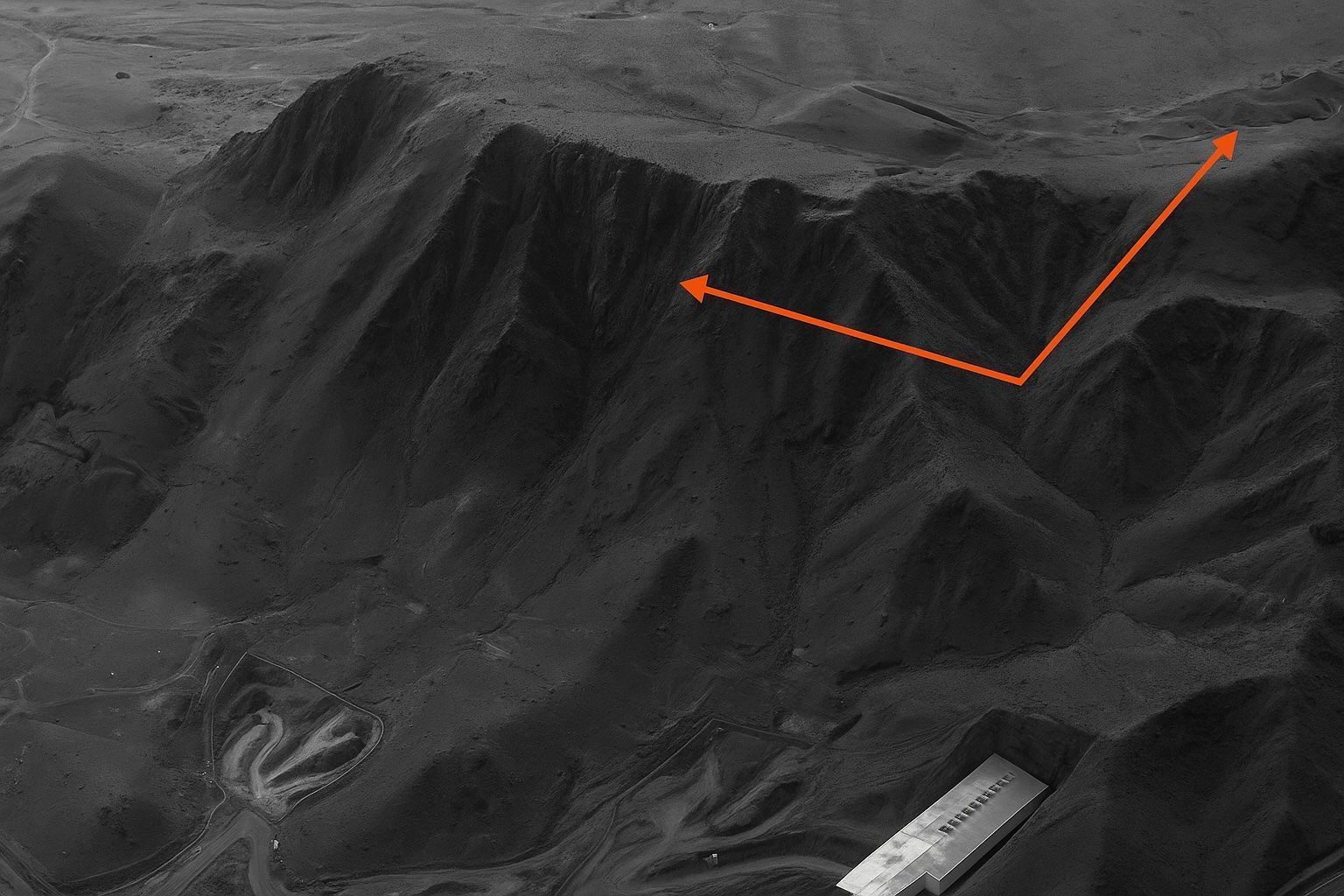
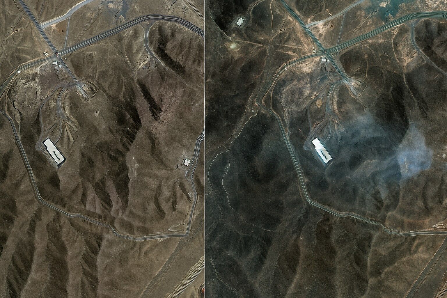
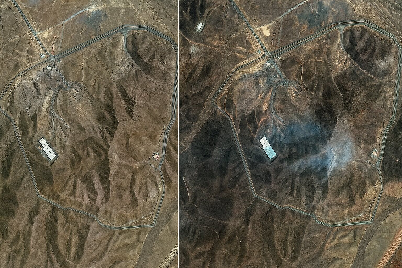
Shortly after 02:00 local time on 22 June, seven U.S. B‑2 Spirit bombers dropped 14 MOPs on Fordow with Tomahawks suppressing Iranian SAM sites. Maxar/Planet imagery shows six precisely spaced entry craters along the ridge above the centrifuge halls, forming a textbook double‑tap pattern consistent with the MOP fuse sequence. Damage signatures include collapsed tunnel portals, landslide debris, scorched support buildings, and dust plumes obscuring the cliff face and vent shafts. Fordow is carved 80–100 m inside Kuh‑e‑Fordow mountain, reinforced by concrete and IRGC air‑defence rings, and was designed for 3,000 centrifuges with IR‑6 cascades enriching to 60%. IAEA Director‑General
Fordow Exposed: Jaw‑Dropping Satellite Images Reveal the Mountain‑Shaking U.S. Strike on Iran’s Deepest Nuclear Stronghold

Fordow Exposed: Jaw‑Dropping Satellite Images Reveal the Mountain‑Shaking U.S. Strike on Iran’s Deepest Nuclear Stronghold

Fordow sits 80–100 m inside a mountain 30 km north of Qom and houses about 3,000 centrifuges, later upgraded with IR-6 machines capable of 60% enrichment. In 2023, IAEA inspectors detected particles enriched to 83.7% at Fordow, signaling near-weapons-grade material. On a June weekend, the United States used a dozen 30,000-pound MOPs in Operation Midnight Hammer, creating at least six cavernous craters in the ridge above the underground halls. Satellite images released on 22 June by Planet Labs and Maxar show twin clusters of three impact holes over what analysts identify as ventilation shafts. The Fordow centrifuge halls lie about
Mind‑Blowing Satellite Images Reveal Fordow’s Cavernous Crater: Inside the High‑Resolution Photo Forensics that Exposed the Collapse of Iran’s Underground Nuclear Fortress

Mind‑Blowing Satellite Images Reveal Fordow’s Cavernous Crater: Inside the High‑Resolution Photo Forensics that Exposed the Collapse of Iran’s Underground Nuclear Fortress

On 22 June at 10:22 UTC, Maxar released 0.5-meter imagery showing three circular Fordow blast scars about 25 meters across at the portal area. Planet Labs’ SkySat captured higher-cadence shots showing eastward dust clouds and bulldozers arriving by noon local time. Five classic penetrator indicators are visible in Fordow imagery: entry craters, radial debris ejection, thermal scarring, rock-face fracturing, and surface subsidence, including uphill fissures and an 8-meter cavity collapse. The Fordow centrifuge galleries are estimated at 80–100 meters deep, leaving uncertainty about complete destruction. Fordow produced 166 kilograms of 60 percent enriched uranium-235 in the last quarter, nearly enough
Go toTop