
Today: 19 July 2026
Browse Category

NYSE:MAXR 20 June 2025 - 22 September 2025

Argentina’s Space Industry Is Taking Off: Inside the Satellite Boom and What’s Next

Argentina’s Space Industry Is Taking Off: Inside the Satellite Boom and What’s Next

Argentina’s journey into space began remarkably early. In the 1940s, visionary engineer Teófilo Tabanera formed the Sociedad Argentina Interplanetaria, making Argentina the first Latin American country with a spaceflight organization en.wikipedia.org. By 1960 – nearly a year before humans reached space – Argentina established the National Commission for Space Research with Tabanera at the helm en.wikipedia.org. Throughout the 1960s, CNIE and the Air Force’s research institute launched a series of indigenous multistage high-altitude rockets, successfully sending scientific payloads to the upper atmosphere en.wikipedia.org. In fact, Argentina became the first country in Latin America to send an object into space on a homegrown rocket, a point of immense national pride en.wikipedia.org.
Space Race Heats Up: Starlink’s 300th Launch, Lunar Rocket Breakthrough & a Trillion-Dollar Space Shield – Sept 14–15, 2025 Roundup

Space Race Heats Up: Starlink’s 300th Launch, Lunar Rocket Breakthrough & a Trillion-Dollar Space Shield – Sept 14–15, 2025 Roundup

SpaceX notched a major milestone with its 300th Starlink mission, continuing its rapid deployment of the satellite internet constellation. A Falcon 9 lifted off from Vandenberg Space Force Base carrying 24 Starlink satellites on Sept. 13, bringing SpaceX’s tally to “the 300th Starlink mission… launched to date, according to the company” space.com. The booster successfully landed at sea for its 28th reuse, just two shy of SpaceX’s reuse record space.com. This landmark launch highlights SpaceX’s “ambitious plan to provide global internet coverage via an extensive satellite network,” as space industry trackers noted keeptrack.space. It was also the 115th Falcon 9 launch of the year, keeping SpaceX on pace for a record cadence space.com.

15 September 2025
Canada’s Space Boom: Inside the Great White North’s $5B Space & Satellite Surge (2025 Report)

Canada’s Space Boom: Inside the Great White North’s $5B Space & Satellite Surge (2025 Report)

Early Pioneers: Canada’s space journey began boldly in the Cold War era. In 1962, Canada stunned the world by launching Alouette-I, becoming the third country to design and build its own satellite asc-csa.gc.ca. Alouette’s success in ionospheric research established Canada’s reputation for scientific satellites. By the late 1960s, Canada was also a telecommunications trailblazer – 1969 saw the creation of Telesat Canada as a domestic satellite operator asc-csa.gc.ca, and in 1972 Anik A1 was launched, making Canada one of the first nations with a geostationary communications satellite for domestic TV and telecom. These early projects were enabled by close cooperation with NASA and a growing cadre of Canadian engineers and scientists. Notably, Canadian technology even found its way into the Apollo Moon landings – the landing gear legs for the Apollo 11 Lunar Module were built by a company in Quebec, underscoring Canada’s early contributions to human spaceflight asc-csa.gc.ca.
10 September 2025
Watch Earth Live from Space – Your Ultimate Guide to Real-Time Satellite Imagery

Watch Earth Live from Space – Your Ultimate Guide to Real-Time Satellite Imagery

Ever wanted to see our planet in real time? Thanks to rapid advances in satellite technology and online mapping, live or near-live views of Earth are increasingly accessible. From following a hurricane’s progress as it happens to monitoring daily changes in forests or cities, a variety of services now deliver frequently updated satellite images to the public. This comprehensive report explores where and how to find real-time satellite images online, compares major platforms, and explains the tech behind “live” imagery. We’ll also look at use cases – from weather and disaster response to environmental monitoring and even aviation – and highlight the latest developments in this fast-evolving field. Read on to discover how close we’ve come to a true live feed of Earth, what’s available today, and what it all means for you.
6 August 2025
Live Satellite Views on the Internet: Platforms, Tools, and Trends

Live Satellite Views on the Internet: Platforms, Tools, and Trends

Ever since the Apollo 17 crew captured the iconic “Blue Marble” photo of Earth in 1972, people have been fascinated by viewing our planet from space. In the digital age, many wonder: What does Earth look like right now? The idea of a “live satellite view” – seeing real-time images of Earth via the internet – has widespread appeal. While no single satellite provides a continuous live video feed of every spot on Earth, a variety of websites, apps, and tools now offer near real-time satellite imagery or frequently-updated views. These range from free public platforms to professional services that deliver up-to-date high-resolution images. This report surveys the notable platforms enabling live or near-real-time satellite viewing, compares their features and accuracy, and discusses recent developments, as well as legal, privacy, and technical considerations. The goal is to understand how close we are to a “live” global view and how these services differ in what they provide.
See Your House from Space? Inside the World of Live Satellite Maps and Weather from Orbit

See Your House from Space? Inside the World of Live Satellite Maps and Weather from Orbit

Satellites have quietly become the unsung heroes of modern life. They play an essential role in our everyday lives, contributing to our well-being and helping meet important needs on Earth Gc. From providing the satellite maps we browse on our phones to enabling the GPS navigation in our cars, satellites are deeply integrated into daily activities. In fact, experts note that space-based satellite equipment is critically important for daily life on Earth, powering everything from real-time communications and banking networks to navigation, weather forecasting, and even internet access for remote areas Cigionline. “When we’re talking about space and what we get from it, it’s really all about communication and data… deeply integrated in almost everything that we do, whether we see the connections or not,” says Jessica West, a senior researcher in space security Cigionline. Indeed, there are thousands of satellites in space today, serving a wide range of purposes – and their impact is absolutely everywhere.
Space News Digest: July 2025 / Updated: 2025, July 5th, 00:00 CET

Space News Digest: July 2025 / Updated: 2025, July 5th, 00:00 CET

Starlink has over 4.6 million users and a constellation of nearly 7,900 satellites in orbit as of mid-2025. The EU Space Act would unify space regulation with debris mitigation, cybersecurity, and environmental standards, with existing Starlink satellites exempt through 2030 but future deployments subject to the Act. France’s SNCF plans to deploy satellite internet on trains by combining terrestrial 4G/5G with LEO connectivity, with Starlink and Eutelsat as leading providers. Boeing won a 2.8 billion US Space Force contract to develop two ESS satellites, with options for two more, targeted for deployment between 2031 and 2033. MTG-S1, the Meteosat Third
Space News Roundup: July 2025 / Updated: 2025, July 2nd, 00:00 CET

Space News Roundup: July 2025 / Updated: 2025, July 2nd, 00:00 CET

The Vera C. Rubin Observatory released its first images from Cerro Pachón, Chile, featuring galaxies and the Trifid Nebula, and will generate 10 million alerts per night with the world’s largest digital camera. NASA’s James Webb Space Telescope directly imaged a Saturn-mass exoplanet orbiting the star TWA 7. MTG-S1, a 1.8-ton satellite carrying the Sentinel-4 instrument, launched on a SpaceX Falcon 9 and will provide 3D atmospheric maps every 30 minutes along with hourly air-quality data. The MethaneSAT satellite, funded by EDF and Bezos Earth Fund and launched in March 2024, has lost power and is likely not recoverable, marking
Latest Satellite News / Updated: 2025, June 29th, 23:59 CET

Latest Satellite News / Updated: 2025, June 29th, 23:59 CET

Commercial Maxar satellite imagery shows Fordo bomb craters rapidly clearing and heavy engineering near damaged ventilation shafts after Iran’s airstrikes, with General Dan Kane confirming the use of 12 Massive Ordnance Penetrator bombs described as turning “night into day”. Natanz enrichment complex repairs have begun, with ISW analysts noting restoration work and reports of a destroyed radar installation in Khuzestan province. Japan launched the final H-2A rocket carrying the GOSAT-GW greenhouse gas and water-cycle satellite, retiring the H-2A after 50 missions with a 98% success rate and equipping GOSAT-GW with a microwave radiometer and greenhouse gas sensor. The H-2A retirement
Bunker‑Buster Earthquake: New Satellite Images Expose Fordow’s Ruin—What the Bombs Hit, What Survived, and Why It Matters

Bunker‑Buster Earthquake: New Satellite Images Expose Fordow’s Ruin—What the Bombs Hit, What Survived, and Why It Matters

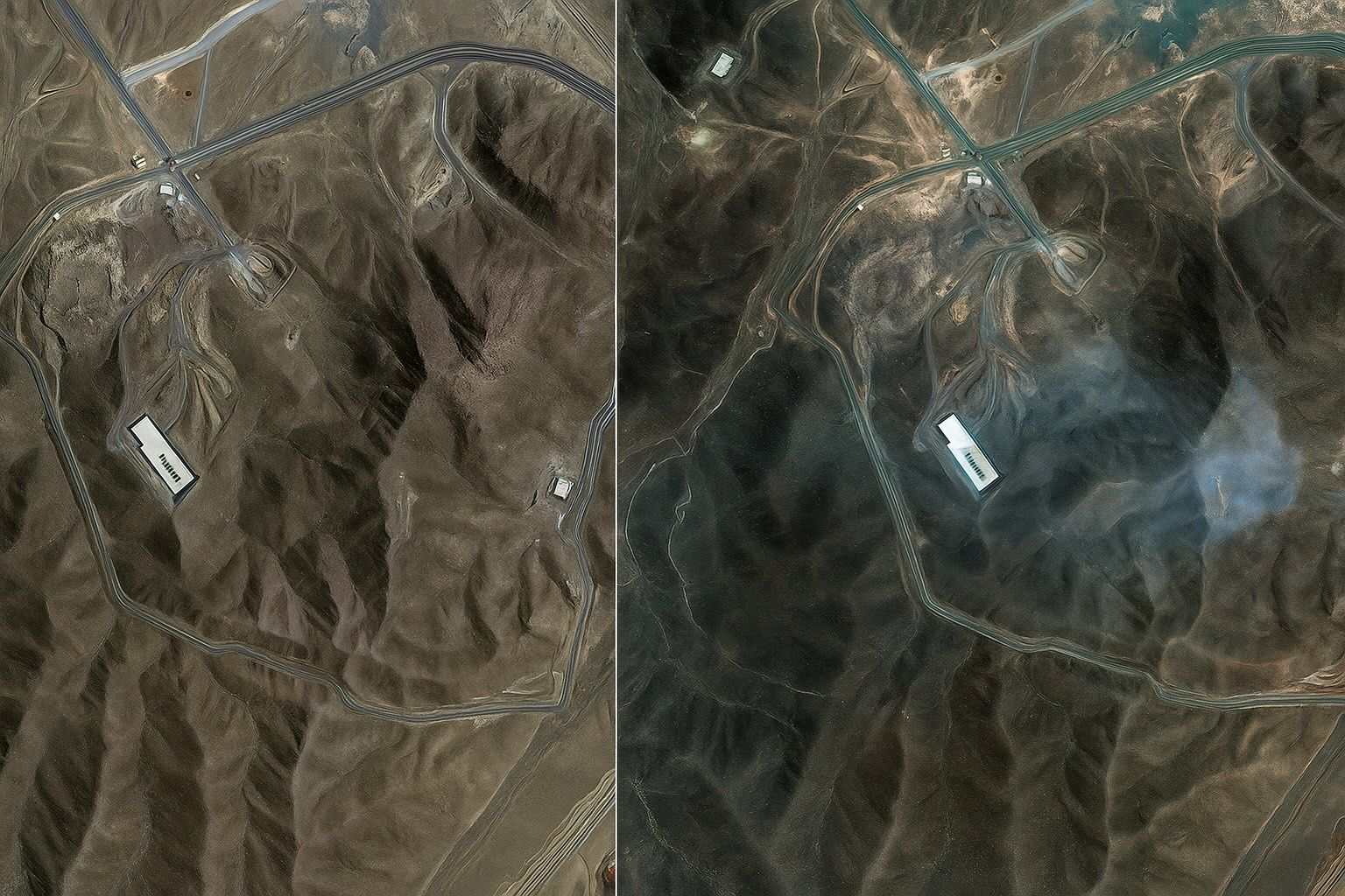
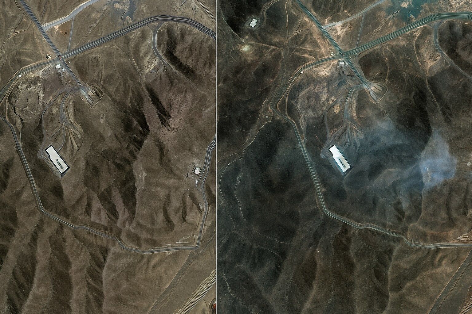
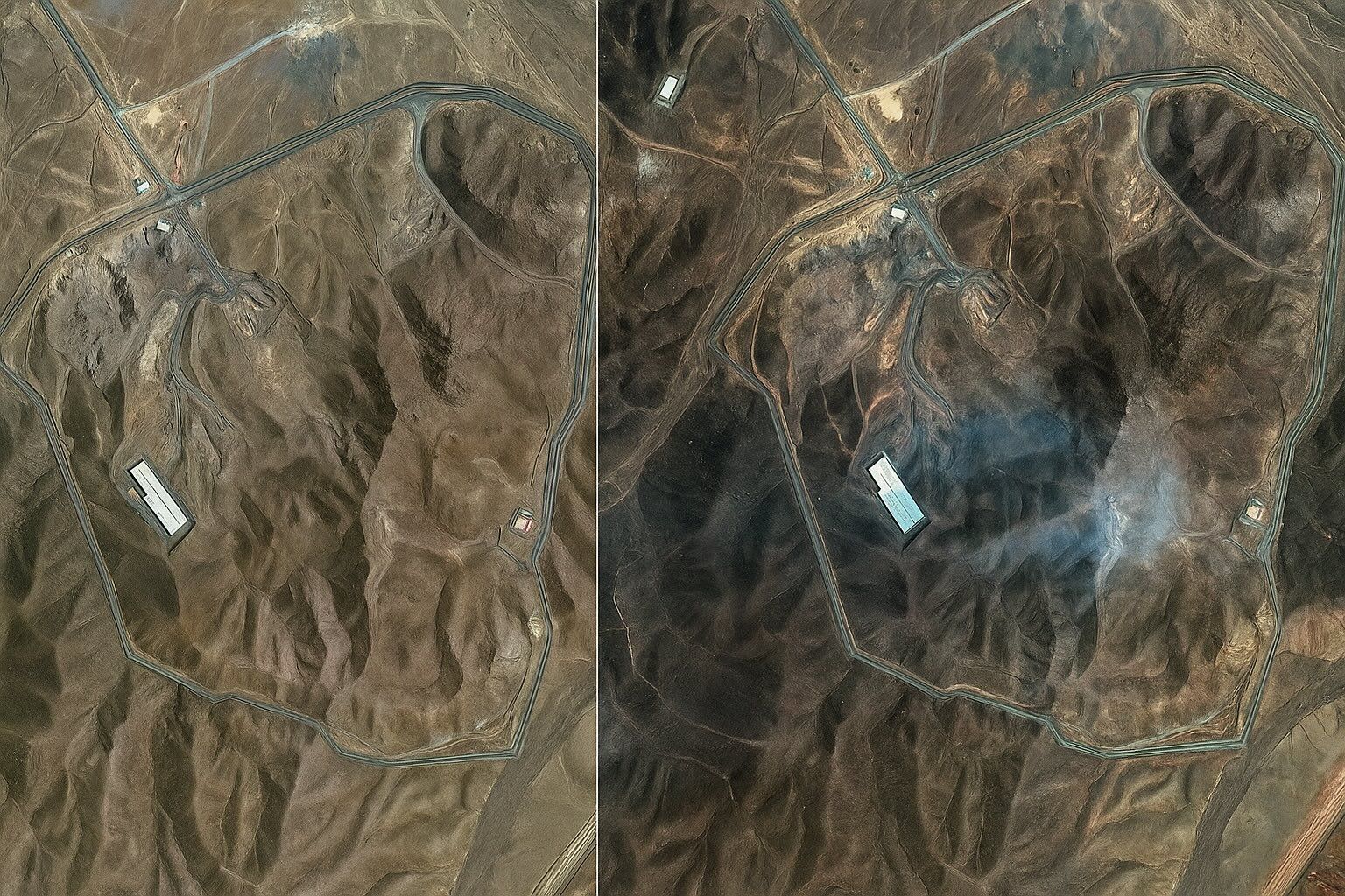
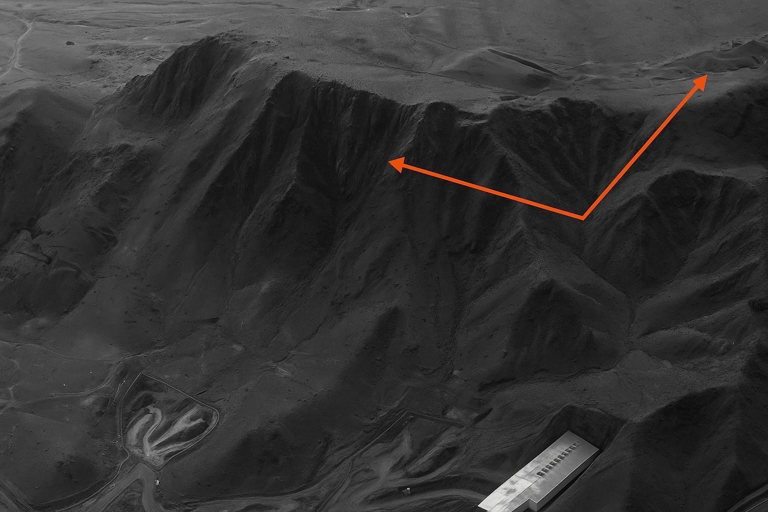
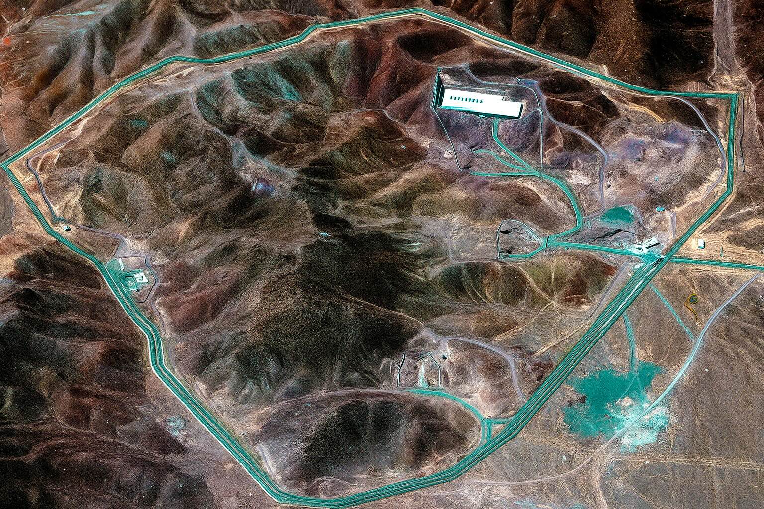
Recent commercial satellite photographs released by Maxar Technologies, Planet Labs and multiple newsrooms confirm that the Fordow Fuel Enrichment Plant outside Qom—the deepest, most heavily‑fortified node in Iran’s nuclear network—absorbed direct hits from U.S. Massive Ordnance Penetrator bombs during the 22 June allied air‑raid. High‑resolution before‑and‑after imagery shows at least six fresh penetrator holes in the limestone ridge above the centrifuge halls, collapsed tunnel portals, landslide debris and scorched support buildings, leading independent analysts and even the U.N. nuclear‑watchdog chief to conclude that “very significant damage” has almost certainly incapacitated the site. Yet Tehran’s denial of catastrophic loss, evidence of last‑minute truck convoys, and the unresolved question of where 408 kg of 60 % enriched uranium went leave the international community guessing whether Fordow’s destruction is a decisive setback or merely a costly pause in Iran’s march toward a bomb. omni.se reuters.com wsj.com ft.com
Fordow Exposed: Jaw‑Dropping Satellite Images Reveal the Mountain‑Shaking U.S. Strike on Iran’s Deepest Nuclear Stronghold

Fordow Exposed: Jaw‑Dropping Satellite Images Reveal the Mountain‑Shaking U.S. Strike on Iran’s Deepest Nuclear Stronghold

In the space of a single June weekend, the Fordow Fuel Enrichment Plant—long considered Iran’s most impregnable atomic fortress—went from hidden menace to smoking headline. Newly released commercial satellite photos reveal at least six cavernous craters in the rocky ridge protecting the underground centrifuge halls, evidence that the United States unleashed a dozen 30‑thousand‑pound Massive Ordnance Penetrators during “Operation Midnight Hammer.” While Tehran insists the facility is merely “scratched,” independent analysts, the UN nuclear watchdog and even some Iranian insiders now concede that Fordow’s enrichment halls may be “structurally crippled,” setting off an urgent debate over what Iran moved out, what survived below, and what comes next. reuters.com reuters.com reuters.com
23 June 2025
Stunning Satellite Images Reveal Fordow Nuclear Facility Cratered by U.S. Airstrike

Stunning Satellite Images Reveal Fordow Nuclear Facility Cratered by U.S. Airstrike

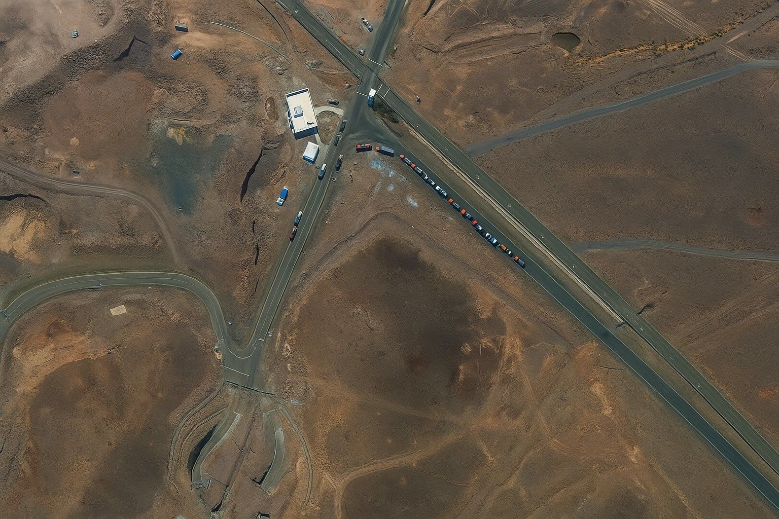
Satellite surveillance captured telltale signs of Iranian preparations at Fordow. On June 19, 2025 a Maxar satellite image shows cargo trucks parked outside the underground entrance of the Fordow complex foxnews.com. The next day another image reveals bulldozers and heavy vehicles moving toward the tunnel entrance foxnews.com. These vehicles were clearly visible in the raw imagery – Fox News reports that “trucks and vehicles can be seen at the Fordow site” in pre-strike pictures foxnews.com foxnews.com. Open-source analysts say this “unusual activity” likely indicates that Iran was shuffling equipment or shielding the facility just before the U.S. raid.
22 June 2025
Mind‑Blowing Satellite Images Reveal Fordow’s Cavernous Crater: Inside the High‑Resolution Photo Forensics that Exposed the Collapse of Iran’s Underground Nuclear Fortress

Shock From Space: Commercial Satellite Photos Reveal How U.S. Bunker‑Busters Crushed Iran’s Fordow Nuclear Mountain

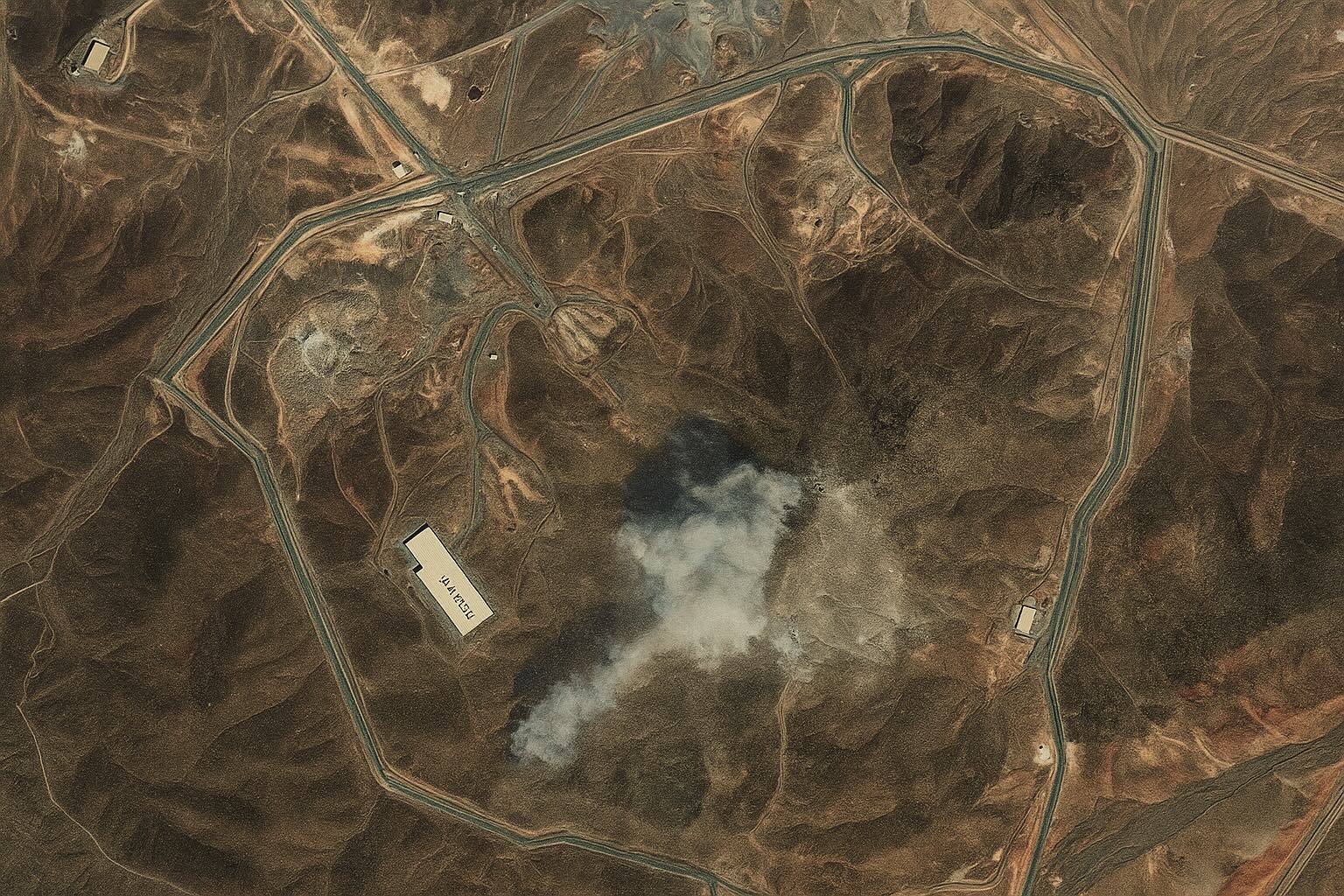
SummaryNewly released high‑resolution pictures from Maxar and Planet Labs show the once‑impenetrable Fordow uranium‑enrichment plant gashed open after the 22 June U.S. air‑strike, with blast‑sealed tunnel mouths, greyed mountain rock and lingering smoke plumes. Image‑forensics, expert interviews and open‑source intelligence indicate that successive GBU‑57 “Massive Ordnance Penetrator” bombs pulverised access shafts, cut external power and likely collapsed internal galleries. While Tehran and the IAEA report no off‑site radiation, analysts say excavation alone could take many months—buying Washington and Jerusalem a strategic pause in Iran’s nuclear advance. Below is a deep‑dive into what the pixels show, how they were interpreted, and what the geopolitical fallout may be.
22 June 2025
Mind‑Blowing Satellite Images Reveal Fordow’s Cavernous Crater: Inside the High‑Resolution Photo Forensics that Exposed the Collapse of Iran’s Underground Nuclear Fortress

Mind‑Blowing Satellite Images Reveal Fordow’s Cavernous Crater: Inside the High‑Resolution Photo Forensics that Exposed the Collapse of Iran’s Underground Nuclear Fortress

A cascade of newly released commercial‑satellite photographs confirms that last weekend’s U.S. bunker‑buster raid on Iran’s Fordow enrichment plant gouged fresh holes into the mountain and triggered a landslide of rock and debris that experts say may have entombed the centrifuge halls. The imagery—captured by Maxar, Planet Labs and others—has become the centerpiece of a fast‑moving open‑source intelligence effort that is mapping the strike’s true impact long before inspectors set foot on site. Below is an in‑depth report that pieces together what the pixels show, what analysts and officials are saying, and what it means for the future of Iran’s nuclear program.
Explosive Satellite Images Reveal Fordow’s Secret Moves Before U.S. Strike—Inside the High‑Stakes Showdown Over Iran’s Nuclear Future

Explosive Satellite Images Reveal Fordow’s Secret Moves Before U.S. Strike—Inside the High‑Stakes Showdown Over Iran’s Nuclear Future

In the 48 hours before U.S. B‑2 bombers punched bunker‑busting holes into Iran’s Fordow, Natanz and Isfahan complexes, a burst of commercial‑satellite photos captured trucks, bulldozers and security convoys swarming Fordow’s tunnel mouths. Analysts read the pictures as a frantic effort to shift centrifuges or shielding materials—clues that helped tip Washington’s calculus toward a lightning strike. What follows is an in‑depth reconstruction of those decisive days, the imagery behind the decision, and what experts say the post‑strike pictures reveal about Iran’s remaining nuclear potential.
Stunning Satellite Images Expose the Full Impact of U.S. Airstrikes on Iran’s Fordow, Natanz and Isfahan Nuclear Sites — What the Pictures Reveal, Why They Matter, and What Happens Next

Stunning Satellite Images Expose the Full Impact of U.S. Airstrikes on Iran’s Fordow, Natanz and Isfahan Nuclear Sites — What the Pictures Reveal, Why They Matter, and What Happens Next

A wave of newly released commercial‐satellite photographs confirms that the 21 June 2025 U.S. strike package—which used B‑2‑launched GBU‑57 “bunker‑busters” and sea‑launched Tomahawks—badly damaged key above‑ground infrastructure at Iran’s Natanz and Isfahan complexes and cut external power to the otherwise deeply buried Fordow enrichment halls. Taken together with on‑the‑record assessments from the International Atomic Energy Agency and leading non‑proliferation analysts, the imagery suggests Iran’s centrifuge capacity has been set back by years, even if the subterranean core of the program survives. This report pieces together what happened, site by site, shows how satellite imagery made it possible to verify battlefield claims within hours, and explains the strategic stakes that now hang on what Iran, the United States and Israel do next.
Jaw‑Dropping Satellite Photos Expose Israel’s Covert Blows to Iran—What the Images Reveal, Why the Targets Mattered, and What Comes Next

Jaw‑Dropping Satellite Photos Expose Israel’s Covert Blows to Iran—What the Images Reveal, Why the Targets Mattered, and What Comes Next

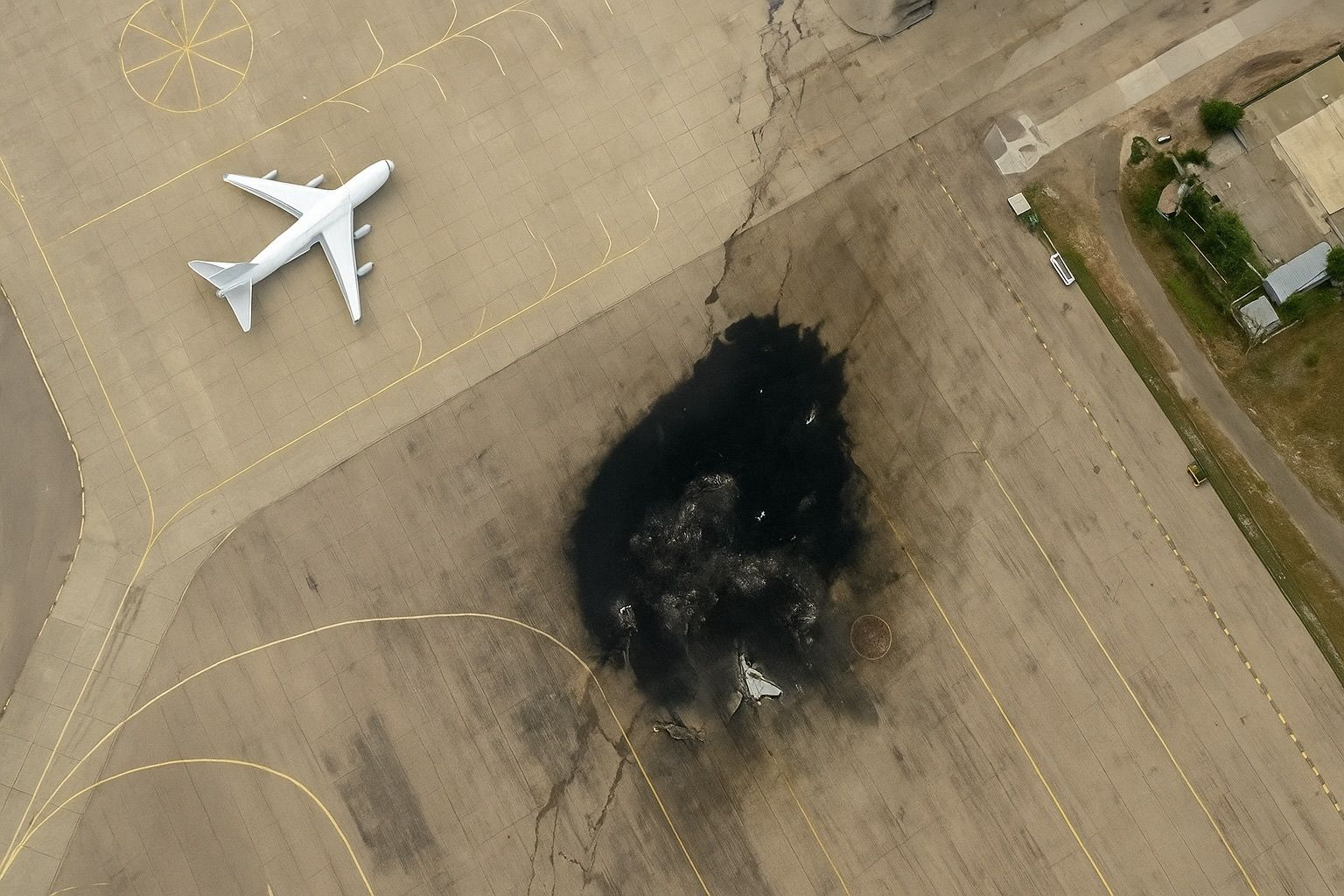
A new tranche of commercial satellite shots has torn the secrecy veil from Israel’s eight‑day air war inside Iran, confirming crippling damage to nuclear, missile and command sites. Independent analysts say Tehran’s premier heavy‑water reactor complex, multiple centrifuge workshops and at least two hardened missile bases have been “neutralised,” while Iranian retaliation has peppered Israeli cities with more than 450 rockets. Below is a deep‑dive that stitches the imagery to on‑the‑ground reporting, expert testimony and UN nuclear‑safety warnings to show how the campaign is reshaping the Middle East chessboard.
21 June 2025
Space Showdown: How Military Satellites Are Shaping the Ukraine‑Russia War

Space Showdown: How Military Satellites Are Shaping the Ukraine‑Russia War

The war in Ukraine is not just being fought on land and in the skies – it’s also being waged in orbit. Since the full-scale invasion in 2022, both sides have leaned heavily on military satellite services for communication, intelligence, navigation, targeting, and early warning. From SpaceX’s Starlink internet constellation keeping Ukrainian forces online to Russian reliance on GLONASS navigation, satellites have become game-changers in modern warfare. Below, we break down the key satellite services deployed by Ukraine, Russia, and their allies, the platforms and players involved, and how space-based technology is influencing the course of the conflict – all backed by publicly documented sources.
Exploring the World from Above: Top Satellite Mapping Services for Web & Mobile in 2025

Exploring the World from Above: Top Satellite Mapping Services for Web & Mobile in 2025

Satellite maps have become an indispensable tool for everyday users and professionals alike. From planning road trips and exploring distant cities to monitoring environmental changes and responding to emergencies, modern mapping services bring high-resolution Earth imagery to our browsers and smartphones. This report dives into the best free and paid satellite mapping services available via the internet and mobile devices, comparing their features, imagery quality, update frequency, offline capabilities, real-time data, historical views, and integration options. We’ll cover consumer favorites like Google Earth and Google Maps, big-tech alternatives from Apple, Microsoft, and HERE, customizable platforms like Mapbox, as well as professional-grade tools such as Sentinel Hub and NASA Worldview for scientific and environmental applications.
Go toTop