Browse Tag

Live Tracking

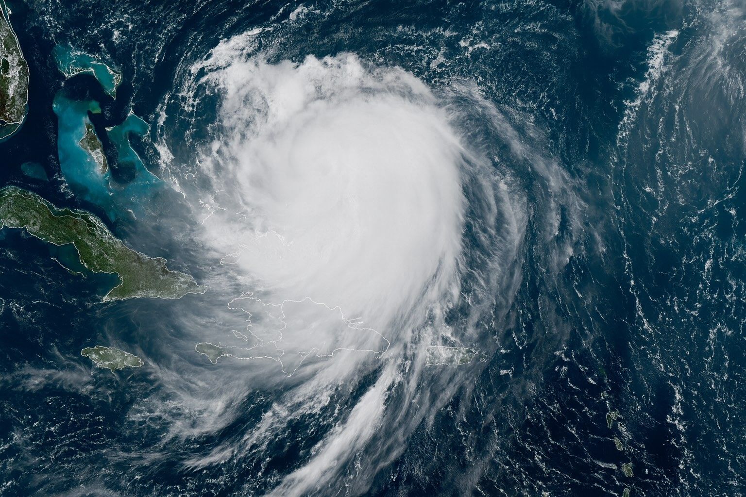
Category 4 Hurricane Erin Churns Off East Coast – Live Tracking, Forecast Path & Expert Warnings

Category 4 Hurricane Erin Churns Off East Coast – Live Tracking, Forecast Path & Expert Warnings

Erin is a Category 4 hurricane with sustained winds near 130 mph as of Aug. 18, 2025. The NHC placed Erin’s center near 24.1°N, 71.5°W, about 695 miles southwest of Bermuda. Hurricane-force winds extend about 80 miles from the center, and tropical-storm-force winds reach up to 230 miles. Forecast models indicate Erin will recur north between Bermuda and the U.S. East Coast, stay offshore, turn north on Tuesday, and accelerate northeast into the open Atlantic. Erin reached Category 5 on Aug. 16, 2025, with peak winds near 160 mph, in just over 27 hours from tropical-storm strength, making it the
19 August 2025
Live Satellite Images and Real-Time Maps: Top Platforms for Web & Mobile

Live Satellite Images and Real-Time Maps: Top Platforms for Web & Mobile

NOAA Earth in Real-Time offers an interactive, real-time global weather map with live imagery from GOES geostationary satellites, updated continuously and accessible free via nesdis.noaa.gov. NASA Worldview provides more than 1,000 global image layers (MODIS, VIIRS, Sentinel-2, etc.) with many layers updated within three hours of observation, plus animation, date comparison, and data download, all in a free web app. Zoom Earth aggregates imagery from NOAA GOES-East/West, EUMETSAT Meteosat, JMA Himawari, and NASA Terra/Aqua MODIS, updating as frequently as every 10–15 minutes and offering a free web and mobile app service. Google Earth provides high-resolution imagery from Landsat-8 and aerial
Go toTop