LIM Center, Aleje Jerozolimskie 65/79, 00-697 Warsaw, Poland
+48 (22) 364 58 00
ts@ts2.pl

Tag: Satellite Images

Bunker‑Buster Earthquake: New Satellite Images Expose Fordow’s Ruin—What the Bombs Hit, What Survived, and Why It Matters

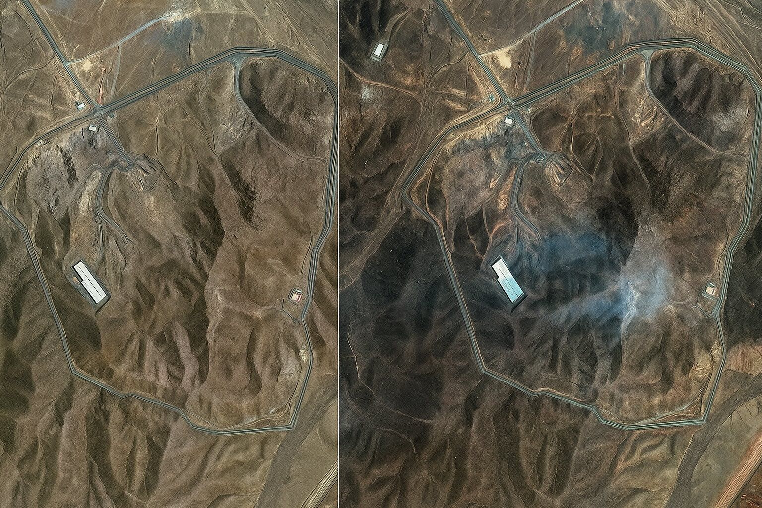
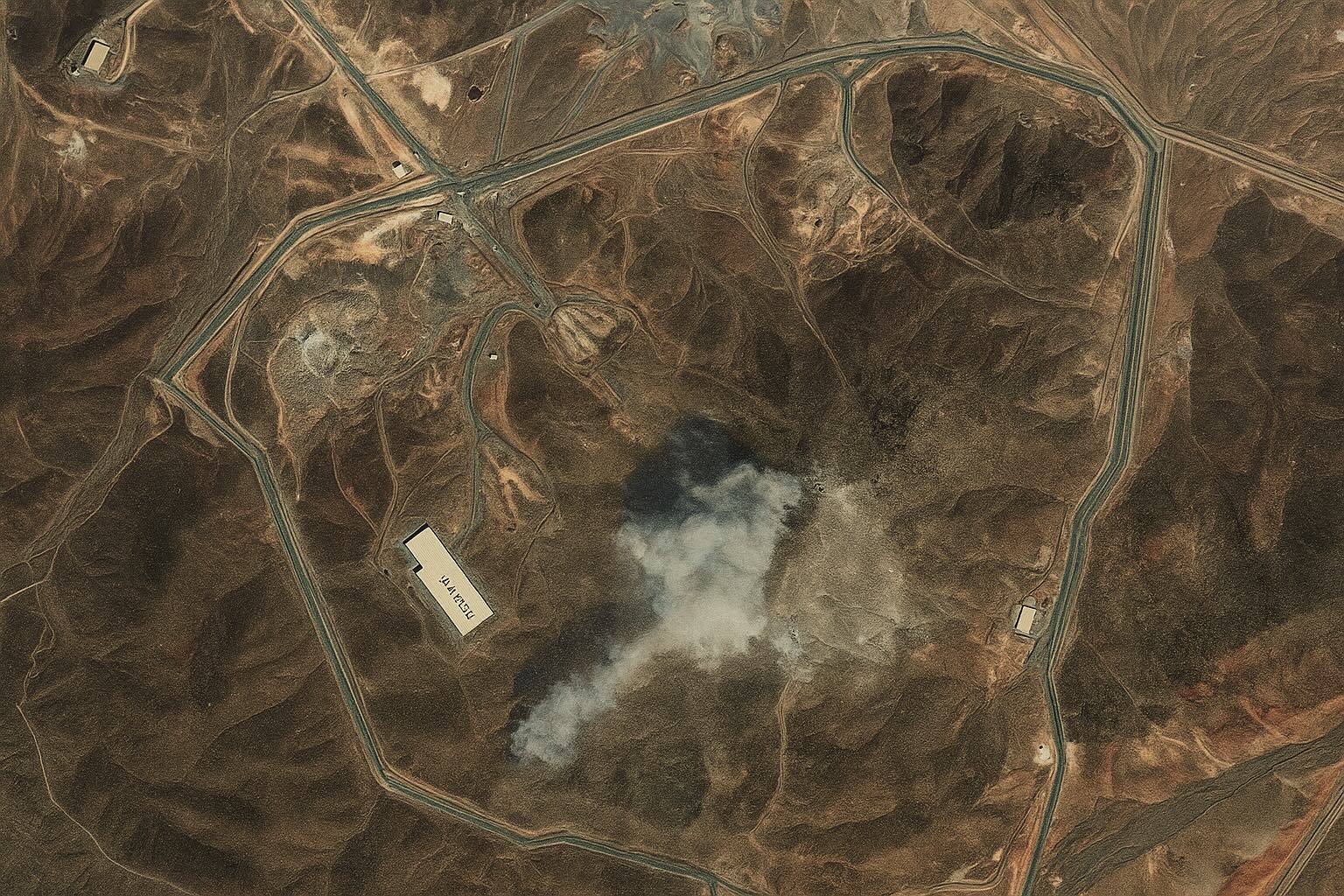
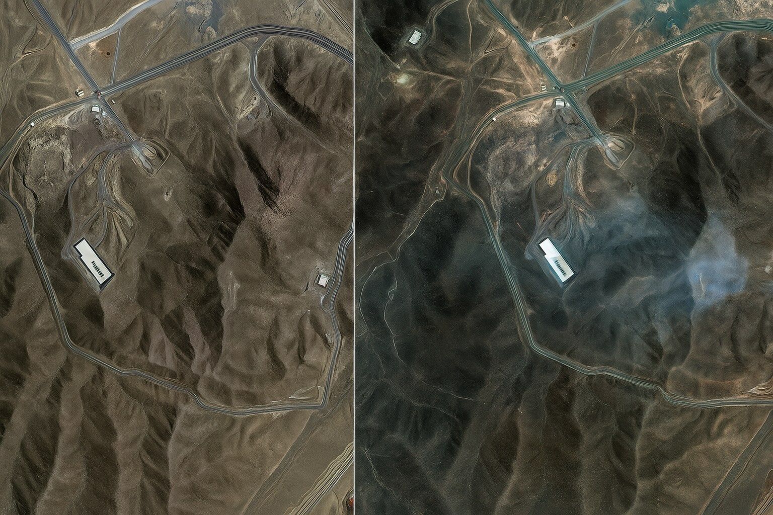
Shortly after 02:00 local time on 22 June, seven U.S. B‑2 Spirit bombers dropped 14 MOPs on Fordow with Tomahawks suppressing Iranian SAM sites. Maxar/Planet imagery shows six precisely spaced entry craters along the ridge above the centrifuge halls, forming a textbook double‑tap pattern consistent with the MOP fuse sequence. Damage signatures include collapsed tunnel…
Read more

Stunning Satellite Images Reveal Fordow Nuclear Facility Cratered by U.S. Airstrike

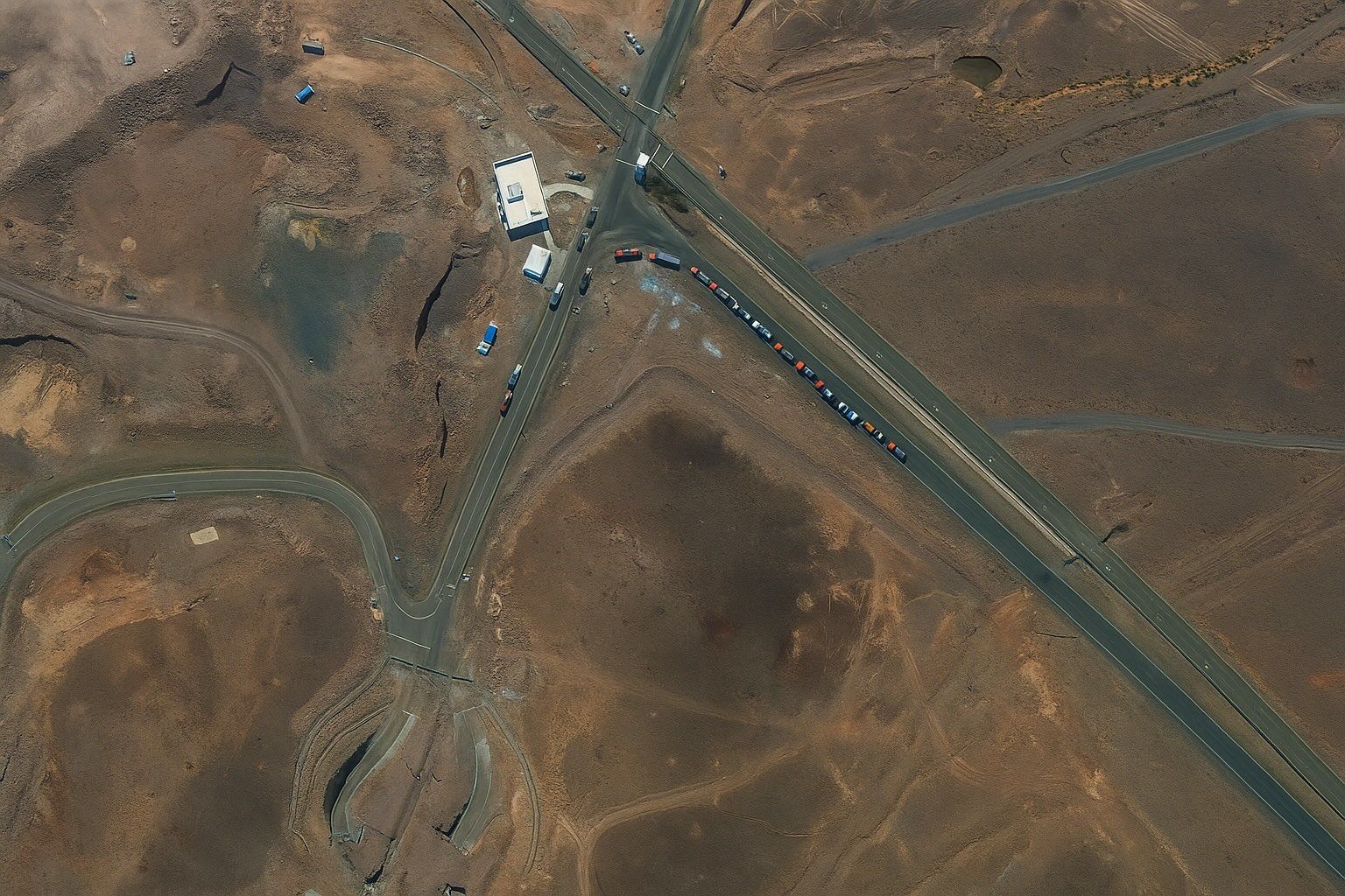
Before the Strike: Trucks and Bulldozers Spotted at Fordow Satellite surveillance captured telltale signs of Iranian preparations at Fordow. On June 19, 2025 a Maxar satellite image shows cargo trucks parked outside the underground entrance of the Fordow complex foxnews.com. The next day (June 20) another image reveals bulldozers and heavy vehicles moving toward the…
Read more

Mind‑Blowing Satellite Images Reveal Fordow’s Cavernous Crater: Inside the High‑Resolution Photo Forensics that Exposed the Collapse of Iran’s Underground Nuclear Fortress

On 22 June at 10:22 UTC, Maxar released 0.5-meter imagery showing three circular Fordow blast scars about 25 meters across at the portal area. Planet Labs’ SkySat captured higher-cadence shots showing eastward dust clouds and bulldozers arriving by noon local time. Five classic penetrator indicators are visible in Fordow imagery: entry craters, radial debris ejection,…
Read more

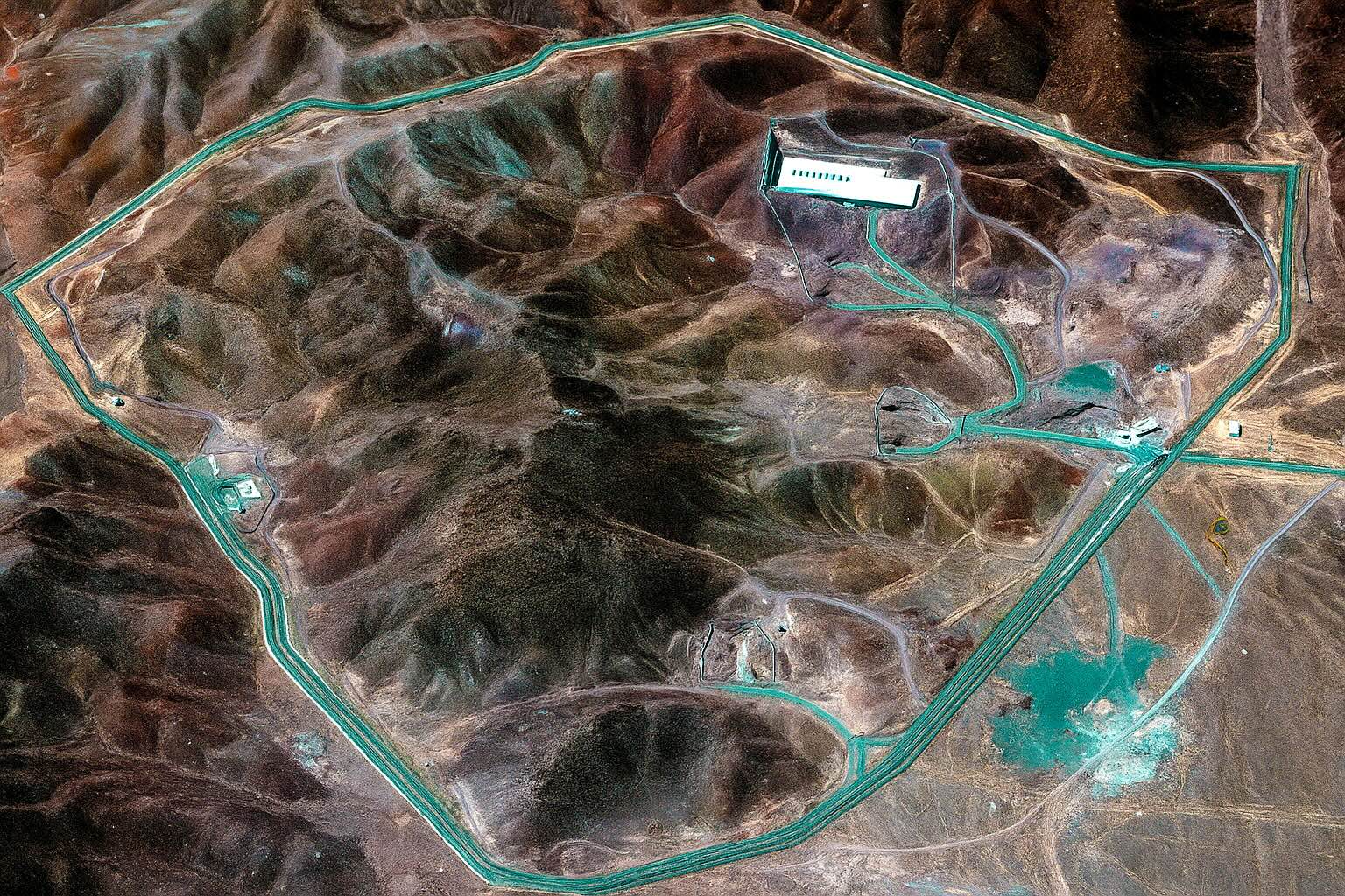
Stunning Satellite Images Expose the Full Impact of U.S. Airstrikes on Iran’s Fordow, Natanz and Isfahan Nuclear Sites — What the Pictures Reveal, Why They Matter, and What Happens Next

On 21 June 2025, the U.S. strike package used B-2 launched GBU-57 bunker-busters and sea-launched Tomahawks to damage Natanz and Isfahan and cut external power to Fordow. Maxar Technologies and Planet imagery circulated minutes after President Trump’s confirmation, enabling open-source observers to map bomb craters, scorched roads, and collapsed roofs at Natanz and Isfahan. IAEA…
Read more