Browse Category

NASDAQ:PL News 29 May 2025 - 22 June 2025

Stunning Satellite Images Expose the Full Impact of U.S. Airstrikes on Iran’s Fordow, Natanz and Isfahan Nuclear Sites — What the Pictures Reveal, Why They Matter, and What Happens Next

Stunning Satellite Images Expose the Full Impact of U.S. Airstrikes on Iran’s Fordow, Natanz and Isfahan Nuclear Sites — What the Pictures Reveal, Why They Matter, and What Happens Next

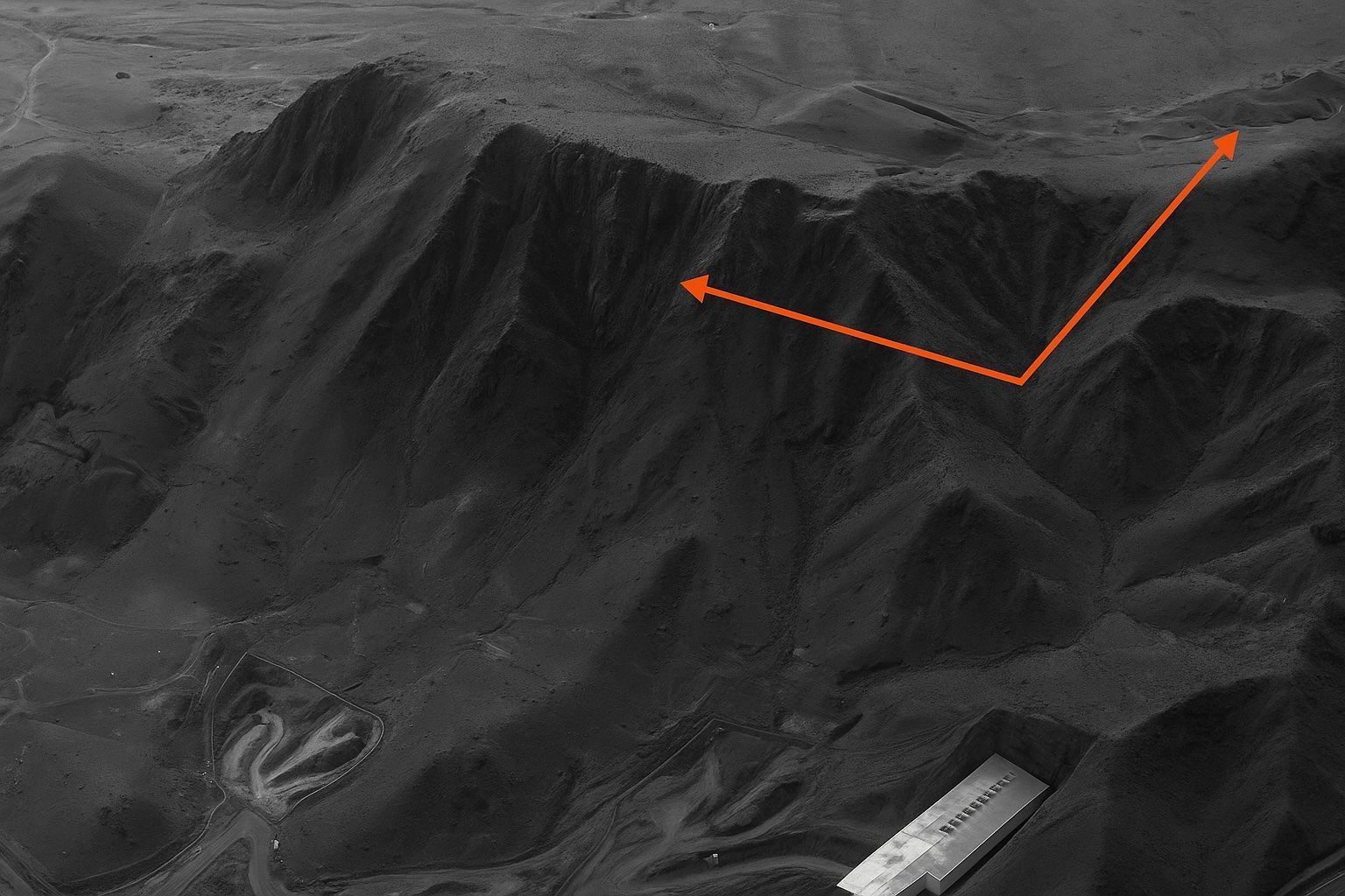
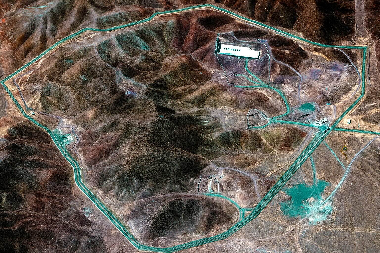
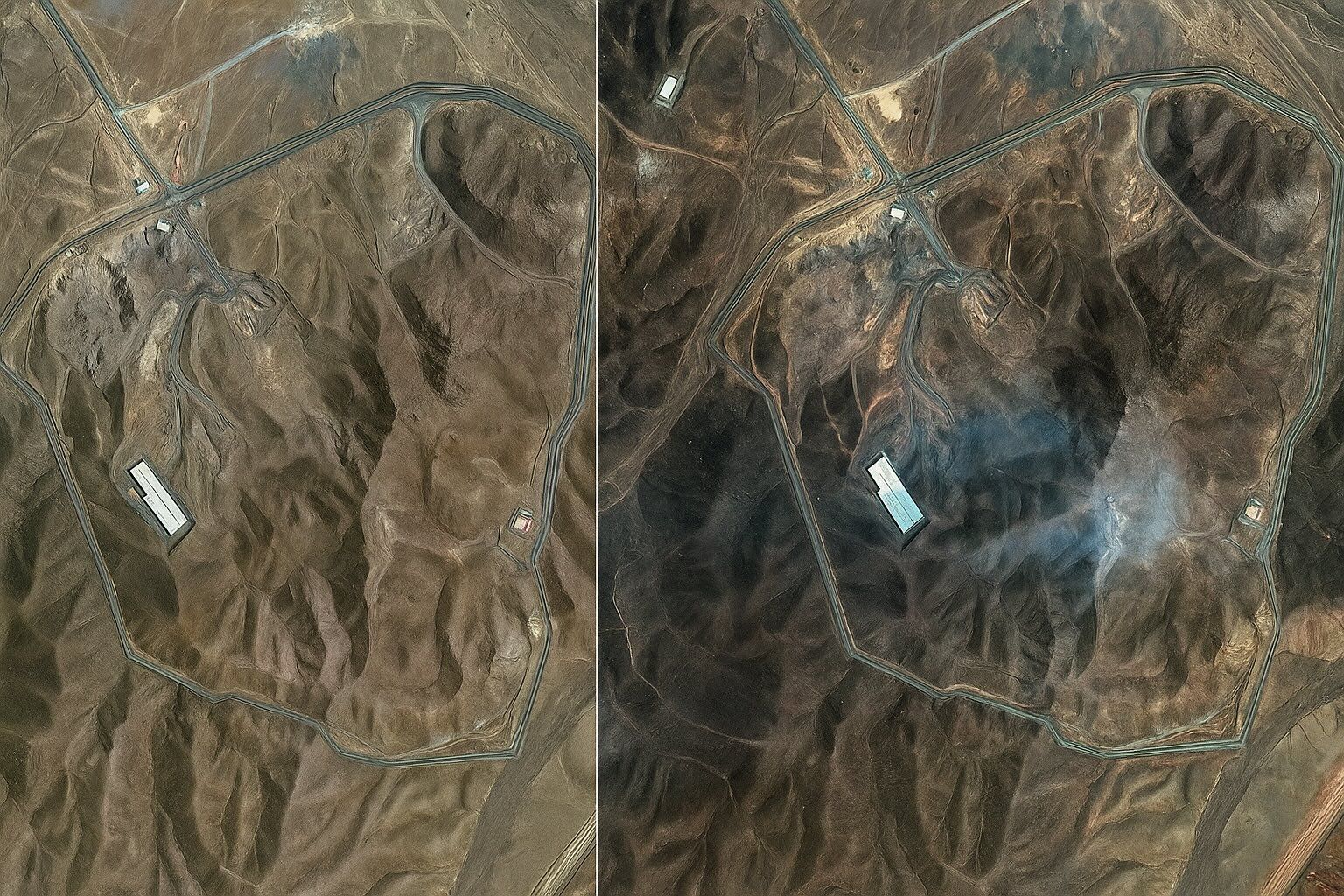
On 21 June 2025, the U.S. strike package used B-2 launched GBU-57 bunker-busters and sea-launched Tomahawks to damage Natanz and Isfahan and cut external power to Fordow. Maxar Technologies and Planet imagery circulated minutes after President Trump’s confirmation, enabling open-source observers to map bomb craters, scorched roads, and collapsed roofs at Natanz and Isfahan. IAEA Director-General Rafael Grossi said the sudden loss of external power made it “very likely” the roughly 15,000 Natanz centrifuges were badly damaged or destroyed, based on satellite evidence. Fordow is buried 80–90 meters inside Mount Kuh-e-Daryacheh and was designed to withstand direct air attack, with
Space Showdown: How Military Satellites Are Shaping the Ukraine‑Russia War

Space Showdown: How Military Satellites Are Shaping the Ukraine‑Russia War

SpaceX deployed 5,000 Starlink terminals to Ukraine within days of the 2022 invasion, rising to about 15,000 active terminals by June 2022, with Ukraine at one point accounting for roughly 58% of global Starlink traffic. Russia attempted to jam Starlink signals on the battlefield, SpaceX rolled a software update to bypass the jamming, and by 2023–2024 reports noted illicit Starlink terminals in Russian hands that had to be disabled. On February 24, 2022, Russia launched a cyberattack against Viasat’s KA-SAT network that crippled thousands of Ukrainian modems and disrupted satellite links across Europe. In August 2022, Ukraine crowdfunded $20 million
Live Satellite Images and Real-Time Maps: Top Platforms for Web & Mobile

Live Satellite Images and Real-Time Maps: Top Platforms for Web & Mobile

NOAA Earth in Real-Time offers an interactive, real-time global weather map with live imagery from GOES geostationary satellites, updated continuously and accessible free via nesdis.noaa.gov. NASA Worldview provides more than 1,000 global image layers (MODIS, VIIRS, Sentinel-2, etc.) with many layers updated within three hours of observation, plus animation, date comparison, and data download, all in a free web app. Zoom Earth aggregates imagery from NOAA GOES-East/West, EUMETSAT Meteosat, JMA Himawari, and NASA Terra/Aqua MODIS, updating as frequently as every 10–15 minutes and offering a free web and mobile app service. Google Earth provides high-resolution imagery from Landsat-8 and aerial
How Satellite Technologies Are Transforming Ukraine: From Warzones to Wheat Fields

How Satellite Technologies Are Transforming Ukraine: From Warzones to Wheat Fields

In August 2022, a Ukrainian charity crowdfunded access to an ICEYE SAR satellite, providing 24/7 all-weather imaging from one satellite and access to ICEYE’s full constellation for over a year. Commercial high-resolution imagery from Maxar, Planet Labs, and BlackSky documented battlefield events such as Russian troop buildups and missile strikes. Analysts have described the Russia-Ukraine war as the most documented conflict in history thanks to the avalanche of satellite data. After the 2022 invasion, SpaceX shipped thousands of Starlink user terminals to Ukraine, and by 2024 Starlink was a reliable frontline communications partner. In February 2022, commercial satellites captured a
Satellite Imagery: Principles, Applications, and Future Trends

Satellite Imagery: Principles, Applications, and Future Trends

The first space images were captured in 1946 from a sub-orbital U.S. V-2 rocket at about 105 km altitude. The first actual satellite photograph of Earth was taken on August 14, 1959 by the U.S. Explorer 6 satellite. In 1960, TIROS-1 transmitted the first television image of Earth from orbit, a milestone for weather observation. Landsat 1, launched in 1972, began the longest-running civilian Earth-observation program with a 50-year archive, and Landsat 9 was launched in 2021 to continue it. The KH-11 KENNEN program began near-real-time digital imaging in 1977, eliminating the need for film return. IKONOS, launched in 1999,
Satellite Technology in Military and Defense: A Global Overview

Satellite Technology in Military and Defense: A Global Overview

The United States operates roughly 120–130 dedicated military satellites, spanning KH-11 imaging, SBIRS/DSP early warning, AEHF/Milstar communications, and the Wideband Global SATCOM network. Russia maintains about 70–80 active military satellites, including the Persona and Bars-M reconnaissance systems, the Liana ELINT network, the GLONASS navigation constellation, and the Tundra early-warning fleet. China operates approximately 60–70 military satellites, featuring the Yaogan reconnaissance fleet, the Beidou 35-satellite GNSS, and the Shentong/Tianlian military communications satellites, along with an active ASAT program. India demonstrated an ASAT capability in March 2019 with Mission Shakti, destroying a satellite in low Earth orbit. Israel’s Ofek series has operated
Go toTop